Cartography & GIS Portfolio
GEOGRAPHICAL VISUALIZATIONS OF THE U.S. - MEXICO BORDER WALL
Cartography Final Project December 2019
Understanding the impacts of the wall on people and the environment.
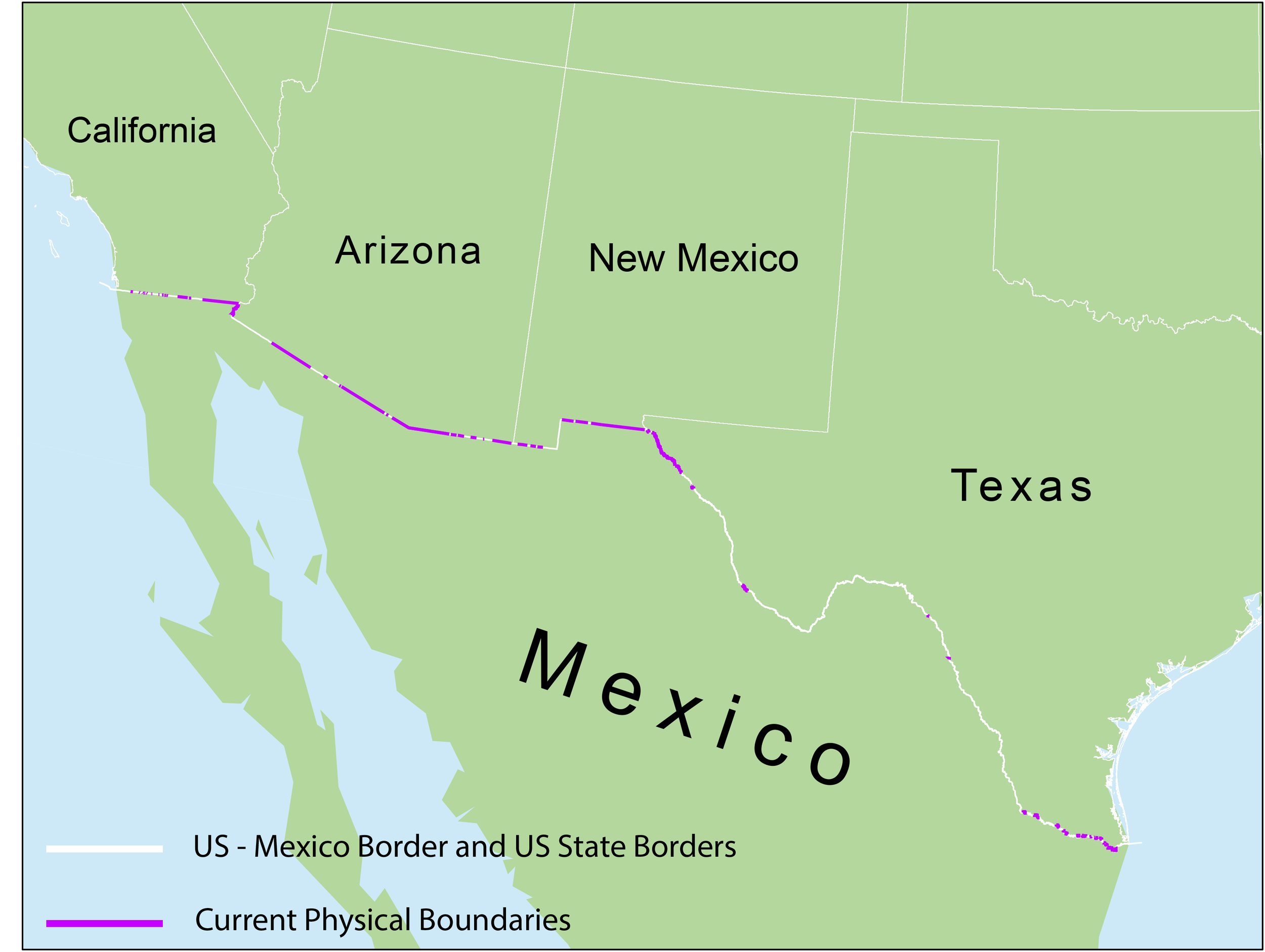
Existing Border Structure
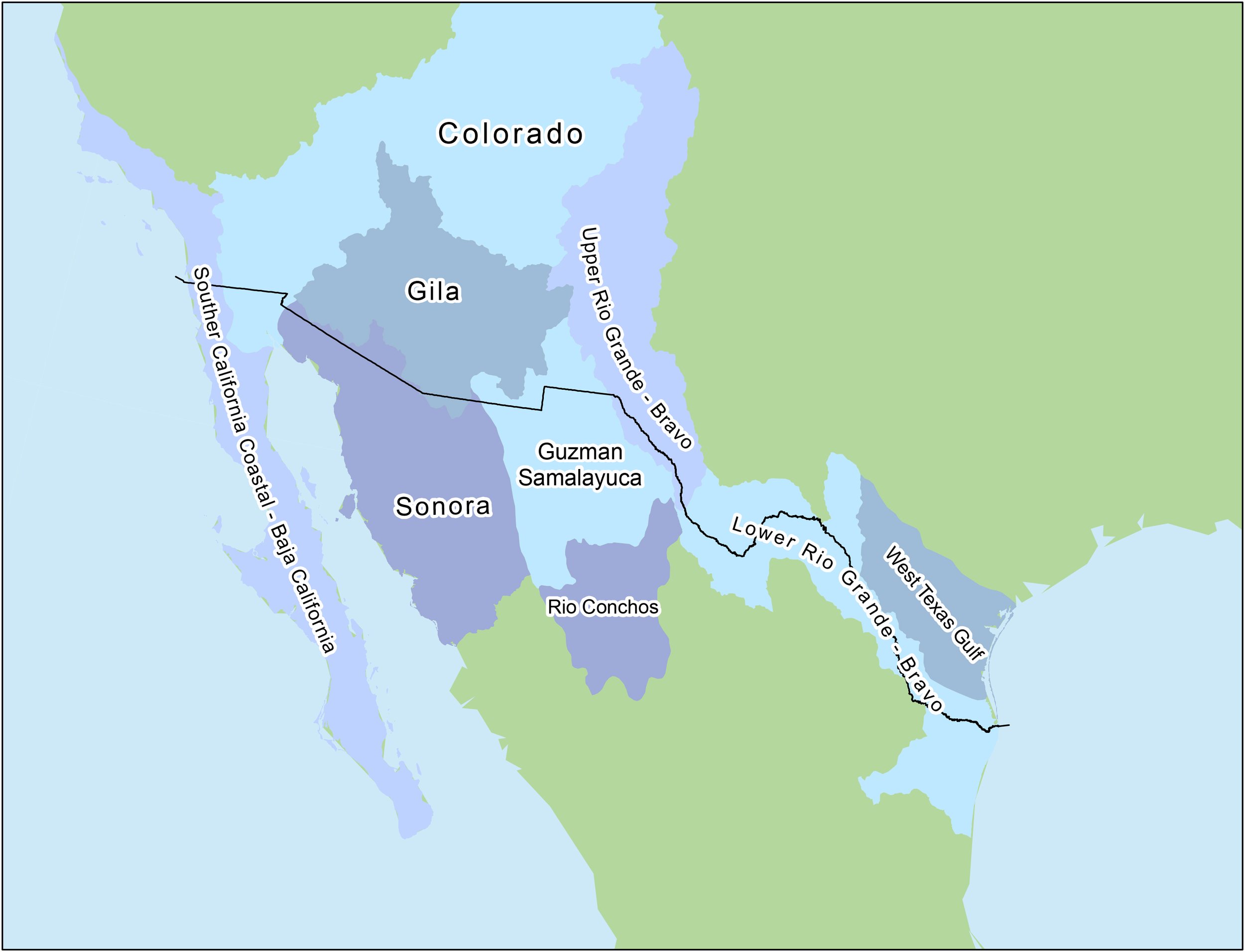
Freshwater Ecoregions
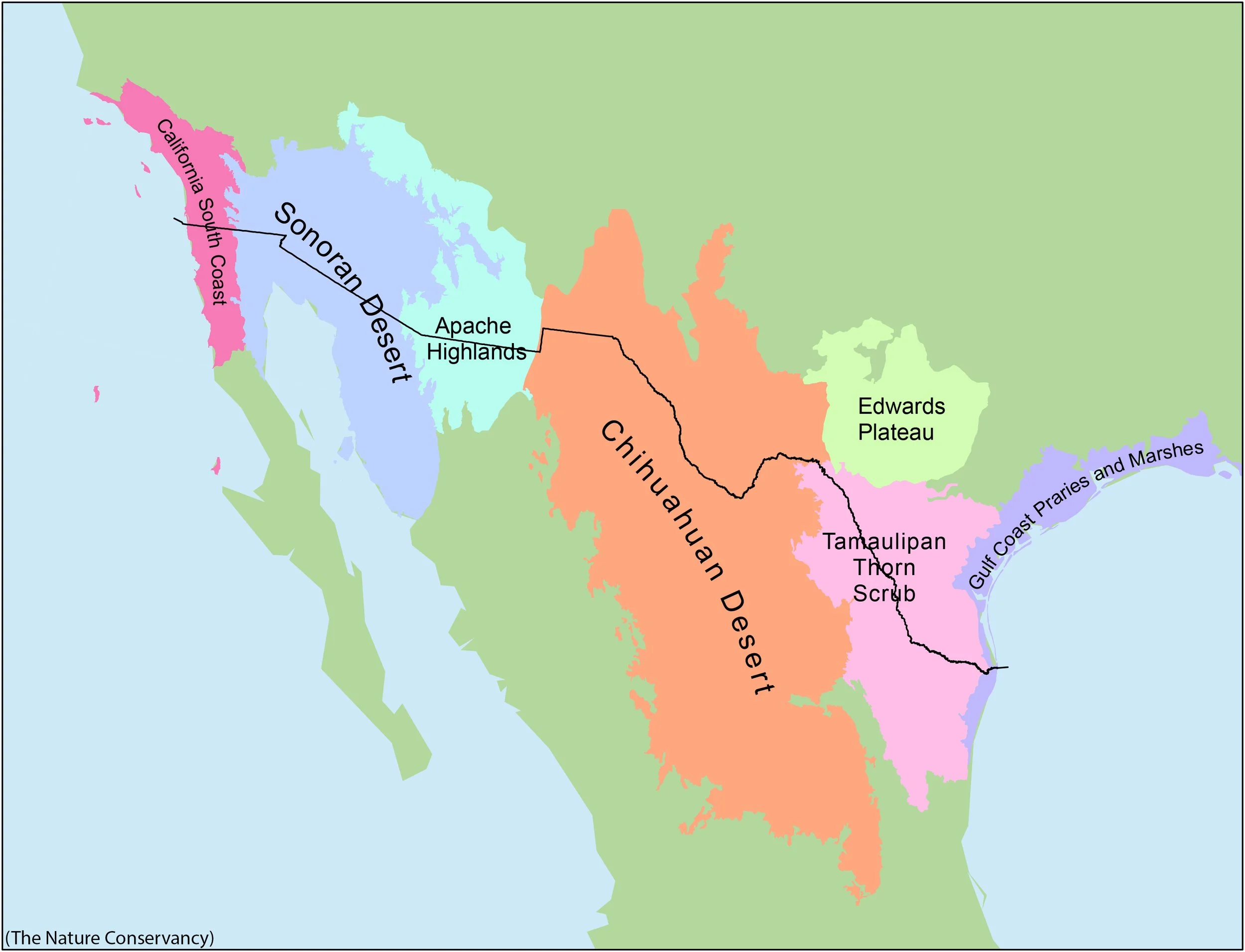
Terrestrial Ecoregions

Communities Divided
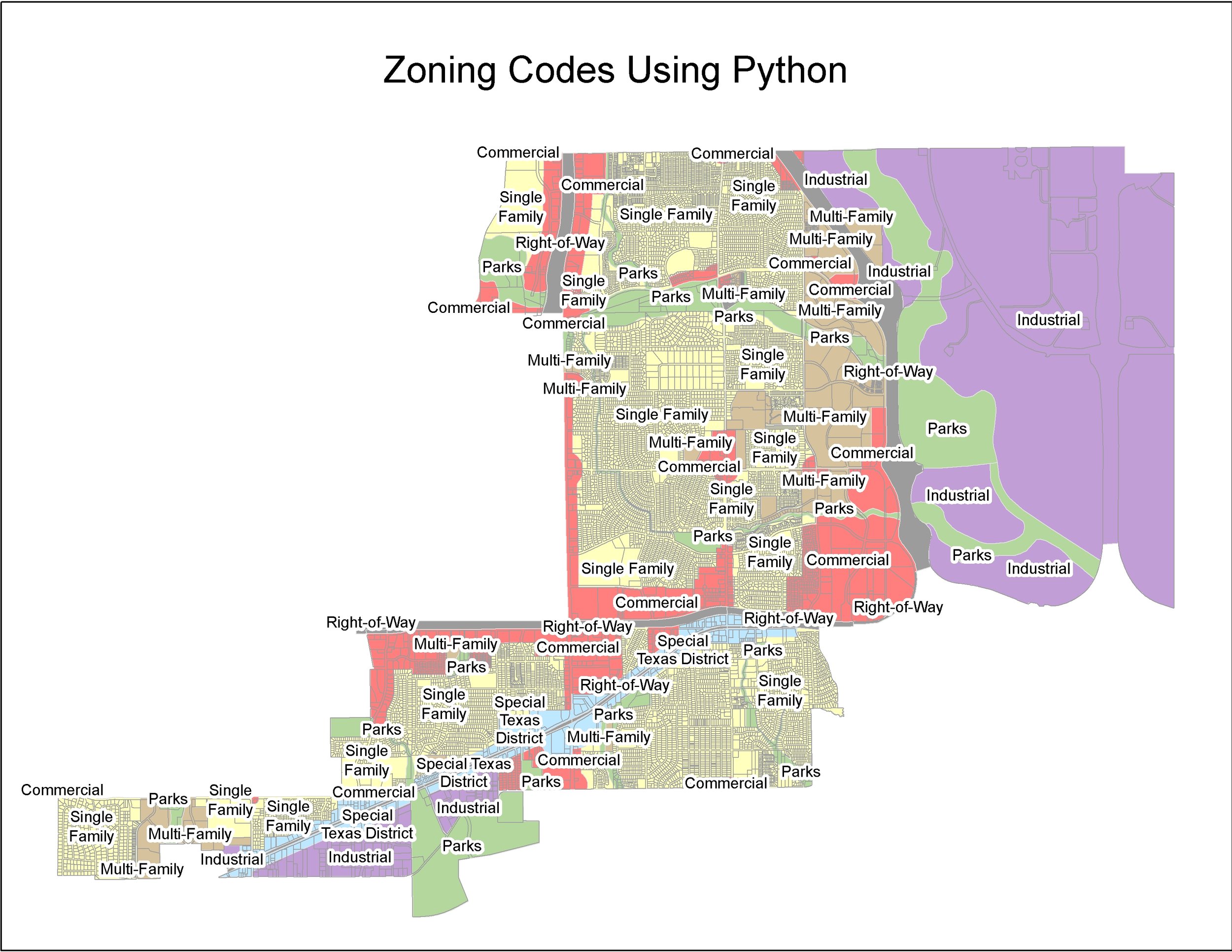
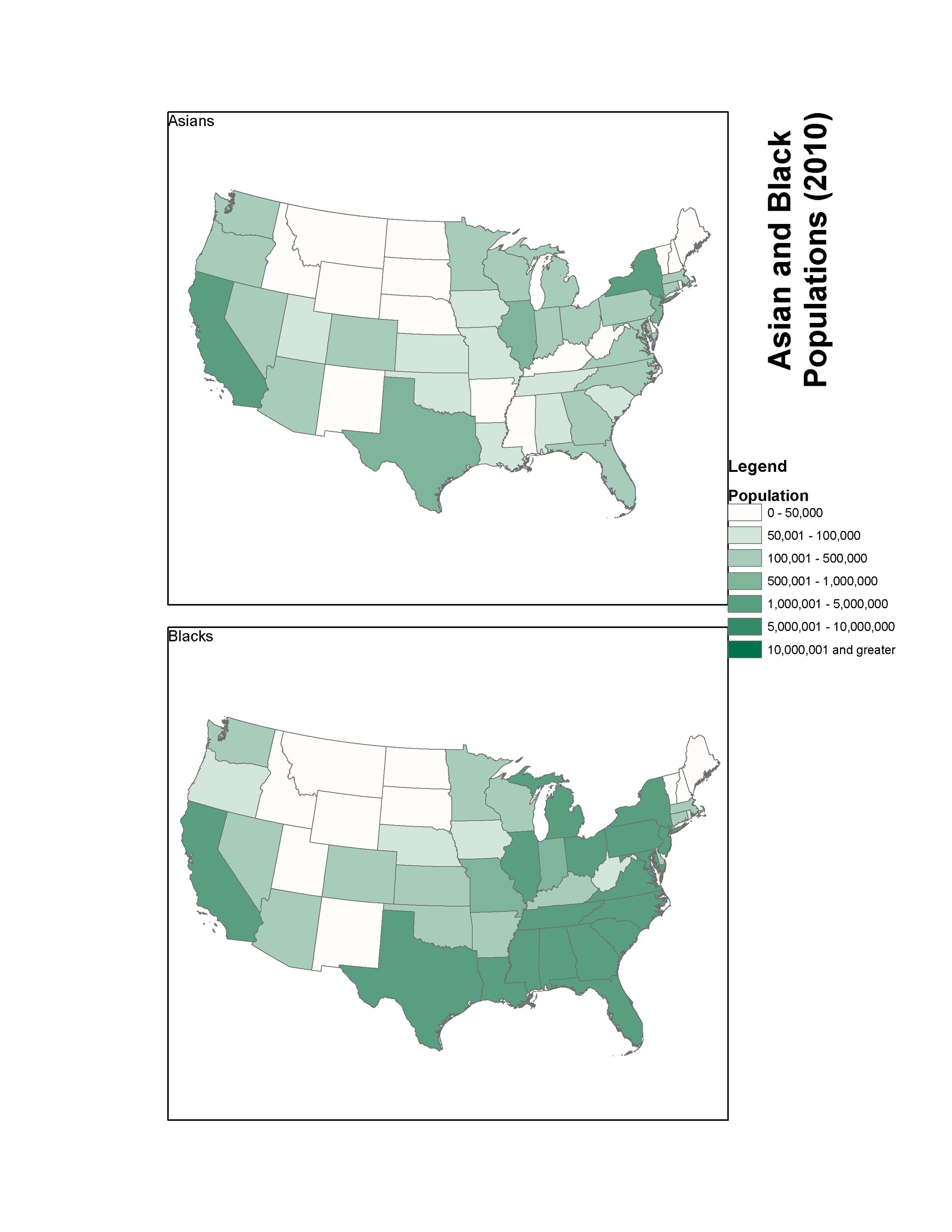
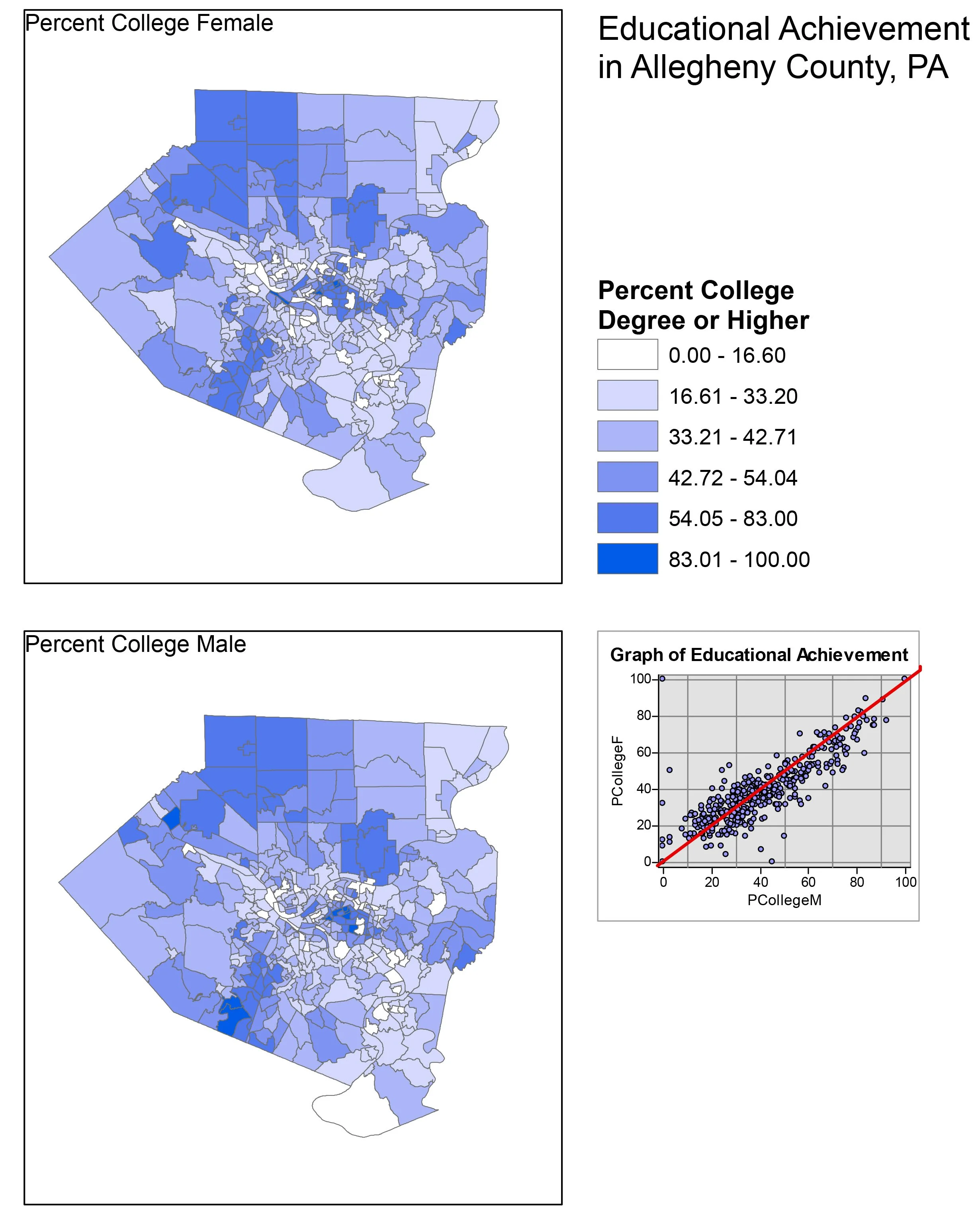
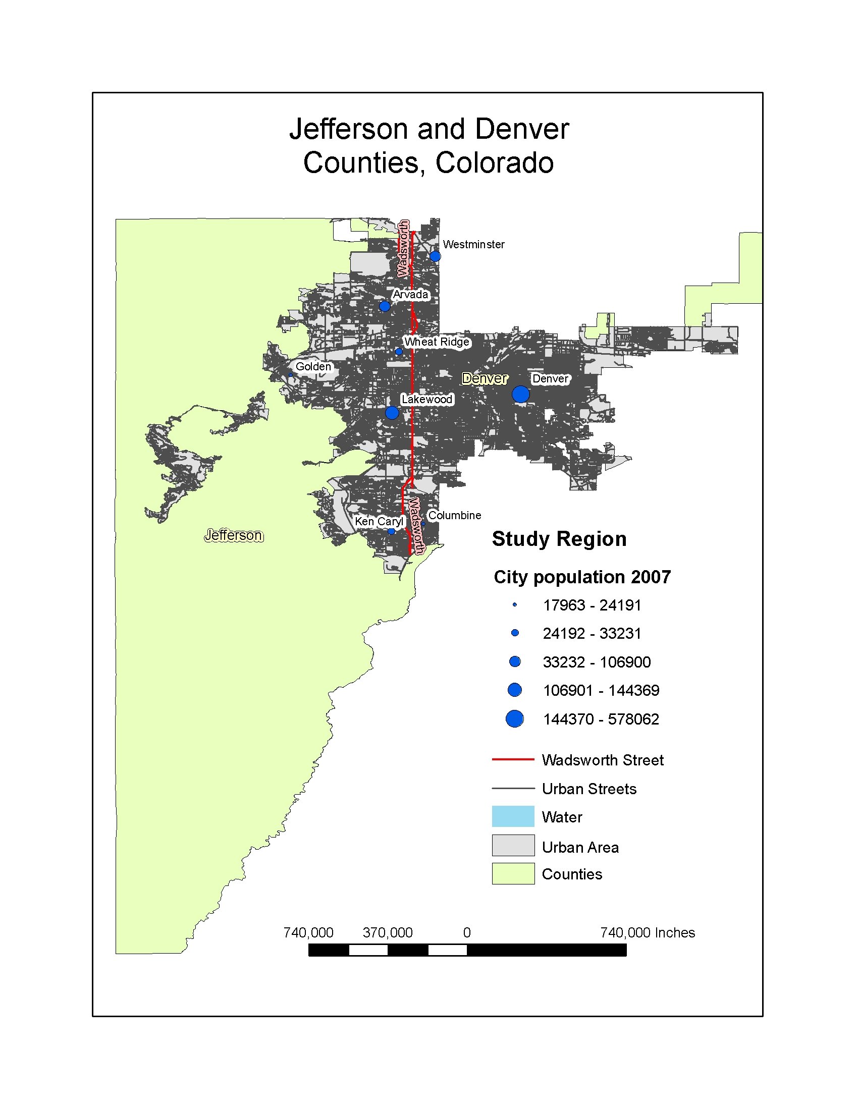
Maps and Data Visualizations